[ad_1]
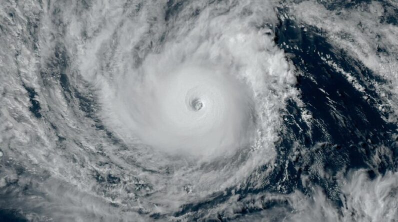
Hurricane Dora at its peak intensity on August 6, 2023.
Source – NASA Earth View. Public Domain
Typhoon Dora is one of only two storms that has journeyed across all three Pacific Ocean basins after it crossed the International Date Line on Friday.
Dora’s journey began back on July 17, 2023, as a cluster of clouds and showers, or a tropical wave, in the eastern Atlantic Ocean off the coast of Africa. The tropical wave took a southern track across the Atlantic and did not further develop because of dry and stable air on its track.
After crossing Central America on July 28 and 29, the system grew stronger and more organized as it entered the eastern Pacific Ocean, becoming a tropical depression on July 31.
The tropical depression became Tropical Storm Dora on Aug. 1, once its winds reached 39 mph. With El Nino strengthening and warm ocean temperatures, it quickly intensified and grew into a strong Category 4 Hurricane.
The storm was then steered by a large area of high pressure into the Central Pacific, having traveled nearly 10,000 miles in total, including 5,000 miles across the Pacific Ocean.
Usually, the waters over the Central Pacific are cooler compared to the Eastern Pacific and this weakens storms considerably. But with no friction or anything in its way, Dora took on a more compact, doughnut-like shape known as an “annular” hurricane.
“That’s important because annular tropical cyclones can wall off the negative factors such as dry air or wind shear longer. They tend to weaken slower than more conventional tropical cyclones,” explained meteorologist Jonathan Erdman in an article on Weather Underground.
The storm passed about 500 miles south of the Hawaiian islands on August 8. However, many meteorologists believe the low pressure associated with Dora contributed to the winds that rapidly spread the devastating wildfires in Hawaii this week.
Even so, Hurricane Dora will go down in the history books as the longest-lasting Category 4 hurricane on record in the Pacific Ocean, according to Hawaii News Now. It joins Hurricane John in 1994 as the only two storms to cross all three Pacific basins.
Now, after 3 weeks since it developed, Dora continues to cross basin to basin over the Pacific. From the Atlantic to Eastern Pacific to Central Pacific and now to the Western Pacific.
According to FOX News, Dora officially reached the international date line, which makes it one of only two storms to do this on record. Dora became Typhoon Dora on August 12 and is a Category 1 storm on the Saffir-Simpson Hurricane Wind Scale.
Cyclones are classified as typhoons when they travel west of 180 degrees longitude which is considered the demarcation between the Central and Western Pacific.
The cyclone is now more than 1,600 miles west of Hawaii, and any indirect impacts on the island chain have diminished. In the Pacific Ocean, Dora isn’t the only storm forecasters are monitoring. Typhoon Lan is a Category 4 storm in the western Pacific that is forecast to hit Japan on Monday.
[ad_2]
Source link


