
[ad_1]
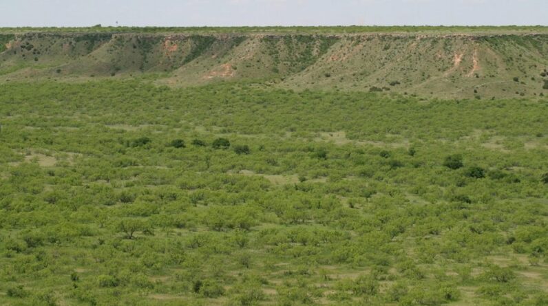
View across Blanco Canyon in late spring of 2009. In the past, Blanco Canyon was carved by springs flowing from the Ogallala Aquifer into the White River. Depletion of the Ogallala Aquifer has reduced or eliminated spring flows and now the White River only flows during major rainstorms.
Source – Leaflet, CC SA 3.0.
Overuse is draining and damaging aquifers nationwide, a New York Times data investigation revealed.
I just filled up my Keurig coffee maker in preparation for making one last cup of coffee while I write this story. But it got me to thinking about how much we don’t think about that clear liquid that comes out of the faucet in the kitchen.
Yes, I am talking about water, one of life’s necessities – not only for humans but for all the animals and plants on Earth. Most of us don’t think about water ever becoming in short supply but it certainly can.
The New York Times conducted a months-long examination of groundwater depletion, interviewing more than 100 experts, traveling the country, and creating a comprehensive database using millions of readings from monitoring sites.
Over 84,500 monitoring wells, all over the nation were examined. The NYT collected data for these wells, which are widely scattered and often poorly tracked, from dozens of federal, state, and local jurisdictions, some of the data dating back to 1920.
 The U.S. Drought Monitor puts 90.2 percent of Utah under Extreme drought conditions. Image – USDA photo by Bob Nichols Public Domain
It didn’t take too long to see that a crisis was under development. Nearly half the sites have declined significantly over the past 40 years as more water has been pumped out than nature can replenish.
And in the last 10 years, four out of every 10 sites hit all-time lows. And last year was the worst yet. It is already a crisis, and yet it is unseen, for the most part.
One of the biggest obstacles is that the depletion of this unseen yet essential natural resource is barely regulated. The federal government plays almost no role, and individual states have implemented a dizzying array of often weak rules.
And this brings up another problem. On a national scale – no one is addressing the crisis. Hydrologists and other researchers typically focus on single aquifers or regional changes.
The deficits are found across the country, including in Utah, California, and Texas, where the depletion is leading to fissures in the ground and buckling roadways. In June, Arizona Gov. Katie Hobbs announced building restrictions that could affect some of the fastest-growing suburbs in Phoenix, the nation’s fifth-largest city, all because of a dwindling groundwater supply.
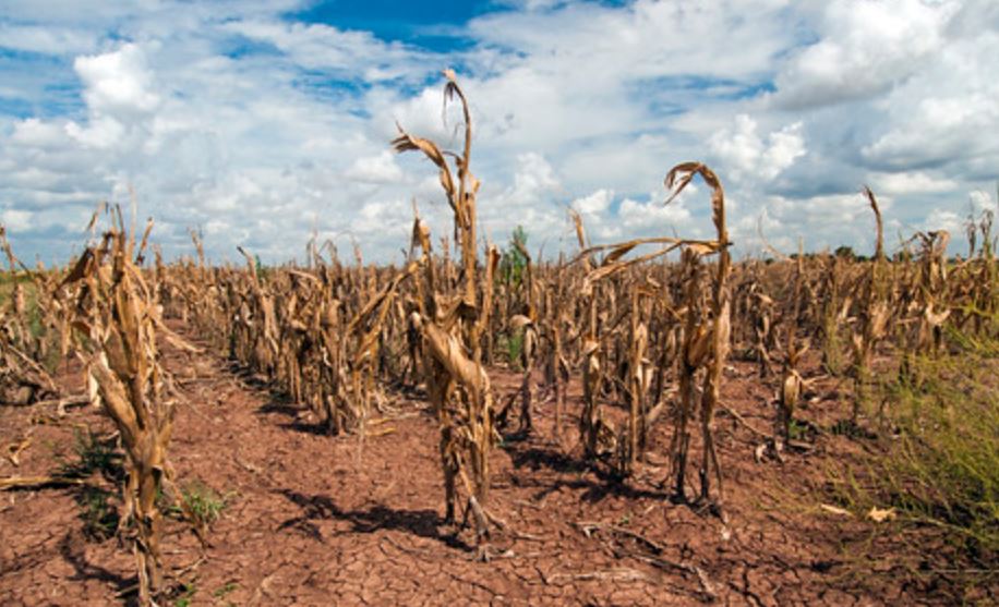
In Kansas, the crisis is already a reality, because there’s little water left to lay down. The wells have begun to go dry. Irrigation can more than double the amount of corn grown per acre. As farms in the area use up the groundwater, corn yields have declined, erasing decades of gains.
Groundwater depletion has led many Kansas farmers to switch to the practice of dryland farming, or farming that relies entirely on rainfall. However, the average rainfall in the area is not nearly enough to make up the difference—Wichita County, for example, gets fewer than 20 inches a year on average.
The region offers a glimpse into the future of America’s farming industry if groundwater keeps getting used up. “We overpumped it,” said Farrin Watt, who has been farming in Wichita County for 23 years. “We didn’t know it was going to run out.”

A two-dimensional map representation of the principal aquifers of the Nation is shown above. This map, which was derived from Ground Water Atlas of the United States data (published as part of the National Atlas in 1998, revised 2003) indicates the areal extent of the uppermost principal aquifers on a national scale.
What is an aquifer?
An aquifer is a geologic formation, a group of formations, or a part of a formation that contains sufficient saturated permeable material to yield significant quantities of water to wells and springs. The areal and vertical location of major aquifers is fundamental to the determination of groundwater availability for the Nation.
A principal aquifer is defined as a regionally extensive aquifer or aquifer system that has the potential to be used as a source of potable (drinkable) water. For study or mapping purposes, aquifers are often combined into aquifer systems.
Basically, an aquifer is like a big container used to store water. The only problem is that it takes forever to fill that container back up.
“There is no way to get [depleted groundwater] back,” Don Cline, the associate director for water resources at the United States Geological Survey, told the Times. “There’s almost no way to convey how important it is.”
[ad_2]
Source link